|
Short Summary of Geology and Topography |

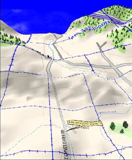
Balloon shows location of site. by Bob Wishoff The topo map above gives a hint as to why the site was used as a camp, and also how the site came to be so well preserved. The topo is exagerated 4X to show how the site we are working lay within the drainway for all the hills surrounding it... Randy's land is an alluvial site, so called because it was covered by alluvium, or silt , soils and rocks which were carried by water and deposited on the low lands during floods. Indeed, all of the land surrounding Randy's place is used for farming as the alluvium deposits make for very arable land. Early people visiting this area would have found much edible plants and many animals to hunt. Fresh water still flows freely on 3 sides of the property. Summary of Geology
Regional Geology
These Cretaceous rocks are primarily fine grained, medium grey limestones that were deposited in a vast shallow sea that stretched from the Arctic to the Gulf of Mexico. Contained within these limestones are chert nodules and bedded cherts. These cherts, siliceous rocks, were the source materials later quarried by early Native Americans for the making of lithic artifacts. In most of the Edwards Plateau area the limestone bedrock is covered by a relatively thin layer of stream bourne sands or local topsoil which was caused by weathering limestone. Such is the case of this archaeological site. Local Geology
|