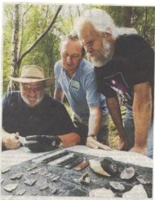
One of the topics that will occupy all
our interests is who has walked this land before we were
here? This is
precisely what Archaeology is all about and why everyone is fascinated
to a
greater or lesser degree. Who has stood where you stand now? Who were
they?
What were they like?
I live on the South Coast of England,
look on the map below and you will see that I live just to the left of
the Isle of Wight in a place
called West Sussex. With my wife, I own a property in a town called
Worthing.
It’s not a big property but I have a front and back garden where, if I
want, I
can go and dig with no one to tell me “no”. Its mine and this land will
grow
things, produce food, make flowers and look after me and it all belongs
to me,
but every now and then I stop and wonder who has said this before? Who
has been
attached to, and nourished by, these few yards of good soil?
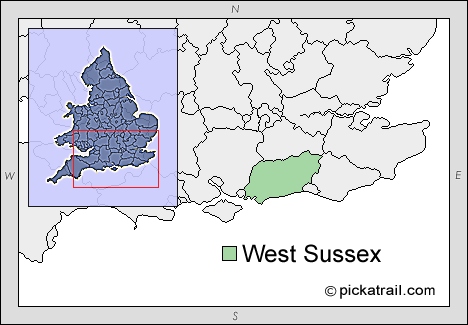
Map of
West Sussex
My piece of land has had people here
before, not just the people who owned the house before me but over the
years
and centuries even millennia. My quest was to find who they were, how
they
lived and are the hypothetical footprints still there for me to find.
The south coast of England is just north
of 51 degrees latitude and where I stand less than 1 minute west
longitude so I
virtually am on the prime meridian. It has a temperate climate and is
warmed by
the Gulf Stream so winters are not usually that severe, but this was
not always
the case. Over the last million years Ice Ages have come and gone and
although
the ice sheets have never quite reached here, quite often this has been
a polar
desert with no plants, animals or life of any kind. It is in this
sometimes
hostile environment that life has come and gone in my garden.
When early man first set foot on my
piece of land is a matter of conjecture but from finds at Pakefield not
that
far away we know that archaic humans were here three quarters of a
million
years ago. That’s 30,000 generations ago a period virtually beyond
comprehension. So did this early forerunner of man walk on my lawn?
Yeah I
would like to think so; it gives me somewhere to start. Somewhere to
put a
stick in the ground and take a small flight of fancy.
Since this far off epoch the ice has
come and gone 6 times, the Cromerian, Anglian, Hoxian, Wolstonian,
Ipswichian
and the Devensian glacial periods have all left their mark upon the
land. My
garden has only been able to support life for about 30% of the time in
all
these millennia but it is in these times of interglacials and
interstadials
that I know where to look where people used this bit of land I call
mine.
So where can I really start and
definitely say here someone lived and walked on my piece of land
To answer this I have to go back 485,000
years
Over many years, in an area about 15
miles to the west of me, many flint handaxes, like those from
Swanscombe, were
turning up in marine sands that were preserved and being quarried. The
geology
of the area showed that the sands were laid down on top of a beach at
the base
of a then 300 foot chalk cliff that extended 25 miles along the then
coast. The
area was a very large embayment that had been cut by a massive river
that would
in time form the Isle of Wight. A huge lagoon full of salt marsh and
grassland
had provided a suitable habitat for animals such as red deer, bison,
horses and
even elephants and rhinoceros. Into this area of plenty had come
Heidelburgensis
the forerunner of Neanderthal who lived well of the live stock and
plants of
this fertile landscape. The area had everything a hunter gatherer could
want
meat, fish, shellfish, berries and a good mixture of edible plants.
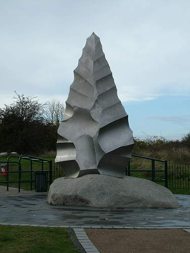
Eastern
face of the Swanscombe Hand-Axe Sculpture in Swanscombe Heritage Park,
NW Kent.
Sculptors David Robinson & Peter Greenstreet of GES Ltd, 2005.
Manufactured
by;
Bob
Hogben,
BH
Engineering.
Flint in the chalk cliffs provided a
ready available source of raw material for hand axes that were used to
kill and
butcher and as the site was repeatedly covered by gently flowing water
the
surfaces were sealed with fine silt that left activity untouched. The
preservation was so good that places where people crouched down to make
their
flint tools have been conserved with every flake discarded still in its
original position. In one place the outline of the knapper’s knees can
still be
seen outlined by the debitage.
So here was my first real encounter with
the peoples who I share the land with. A group of hunter gatherers who
killed
and butchered large animals and left their bones and tools where they
were used
The raised beach that was discovered at
Boxgrove extends from Portsmouth to almost my front door and is now
through
orthogenic movement in the last half a million years 40 metres above
sea level
and there has been a series of digs along its length where and when it
outcrops.
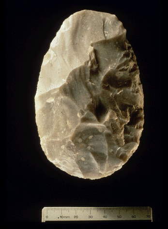
Biface
found at Boxgrove. More to be found at the
official Boxgrove website.
I teach illustration, planning and
section drawing at Sussex University and therefore get involved in many
digs
with the professional units as their site recorder. The Boxgrove
project (put
Boxgrove project in your search engine or Valdoe project or Slindon
Bottom) has
been extended and in my next chapter I will report on the digs and the
finds
Chapter
II Digging the Lower Palaeolithic
I must start with some geology to set
the scene. Following the Jurassic, 136 million years ago, the whole of
the
South of England was immersed in a shallow warm sea and this laid beds
of
various materials down starting with a series of clays called the
Wealden beds.
This was overlaid by the lower greensand then the gault marine clay and
upper
greensand and it was on these beds that the chalk was laid down. [editor's note: You can read more about
this, here: http://easyweb.easynet.co.uk/~gcaselton/fossil/fossil.html]
Chalk is a 98% pure calcium carbonate
although the lower “grey” beds can contain clay minerals, silt grade
quartz and
glauconite. The upper beds epitomised by the white cliffs of Dover
contain a
series of layers of flint that made the region such an attractive
proposition
for early man. These white beds, up to 1100 feet thick were laid down
very slowly
it is estimated at about an inch every thousand years. Subsequent
tertiary
folding uplifted the Downs into a dome and depressed what would
eventually
become the English Channel. In the last 64 million years further
folding and
subaerial erosion produced the present day structure and topography.
Sea erosion into this uplifted land
produced cliffs and because chalk is so friable the wearing away
continually
exposed the embedded flint that made beaches and pebble deposits.
In Sussex we have a series of “old”
beaches buried in places by tertiary deposits and exposed in others. It
is one
of these beaches that were being formed in the lower Palaeolithic when
early
man used it as a hunting and living area. Due to orthogenic movement
this
raised beach is now well above sea level at the 40 metre contour.
Near the tiny village of Boxgrove there
are quarries extracting aggregate and for a long time hand axes were
found that
promoted investigation into the site. The area is between two inliers
of chalk,
the Portsdown anticline to the west and the Littlehampton anticline to
the
east. The northern boundary is a relic buried cliff and it was at the
base of
this buried cliff that the beach developed. The south of England is
tectonically active so the relationship to present day compared to half
a
million years ago has somewhat changed. The cliff is still there but
now only
about 35 feet high and lies below a considerable amount of overburden.
In the last 10 years since the first
discoveries at Boxgrove bore holes have been sunk following the old
cliff line
sometimes up to 30 to 40 feet deep and at Slindon Bottom the ancient
beach
currently lies exposed so we now know where it is so since 2006 a
series of small
pits have been dug to sample the beach itself and the overlying strata.
Unless you are clearing a large area for
health and safety reasons trenches must not have vertical sides of more
than 5
feet (1.5 metres) so the first requirement for any excavation is a JCB
or
similar mechanical excavator. It is very easy to tell the depth in
terms of
ancient deposits as a series of sands and silts is very well defined.
The finds
bed is delineated by the residue of the salt marsh and decayed plant
life into
a layer called the Mg.Fe. layer (magnesium and iron) that is a brown
bed about
a quarter of an inch thick and looks for all the world like a
crème brulee.
This layer is all that’s left of the marshy horizon and its contrast to
the
bluish sandy silt above it is very pronounced.
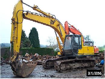
A JCB
excavator.
Before we go into detail about the
raised beach itself and the archaeology let me relive for you the
latest
excavation at the Valdoe quarry to give a feel of what its like to dig
this far
back into the past. The position of the beach was known from a series
of bore
holes carried out the year before and the site itself is about 2 miles
west of
the main Boxgrove quarry.
Climate is what you expect but weather
is what you get and the first day did not let us down. Cold wet and
what can
only be described as miserable. We parked our cars just off the
Goodwood road and
started the quarter of a mile trek down a puddle path to the site. Bore
hole
information had revealed that we needed to go down some 3 metres (10
feet) so
the JCB had removed the overburden so the site descended in three steps
and had
stopped at 2.5 metres. The first job was to clean back the western and
northern
walls and expose the strata so a geological record could be made of all
layers
from the top soil down and to make safe the two intermediate platforms.
The
final cut was a trench 2.1/2 metres by 1.5 metres but the surface cut a
6 metre
square.
The geology of the site was quite
complicated with, from the top downwards, top soil and leaf mould and a
mixture
of top soil and gravel. Below this was a series of beds with
solifluction
gravel intruding into three separate dry valley deposits. Following
this was a
series of calcerous solifluction gravels and a broad layer of lower
brick
earth. Just above the MgFe layer was a thin white layer of chalky marl
and
below the various Slindon silts.
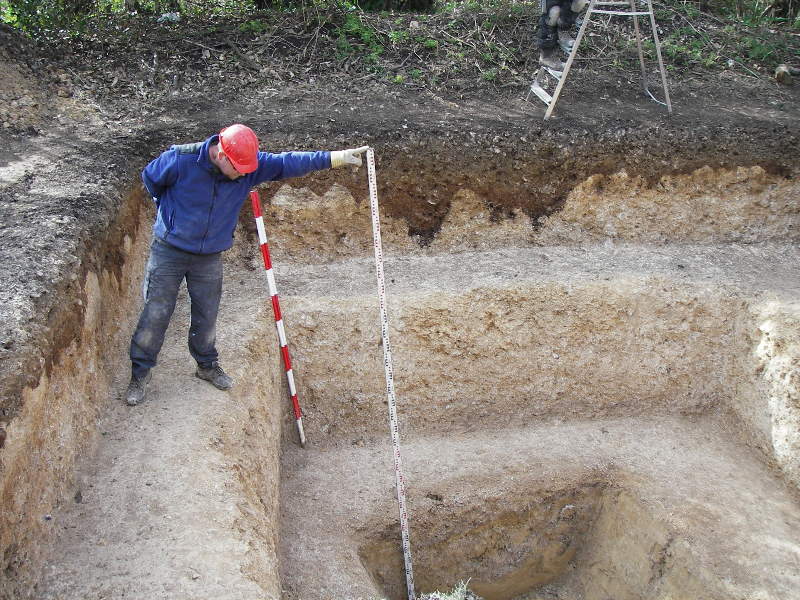
A look at
the stratigraphy mentioned above.
Finds were confined to the lower part of
the brick earth and the top of the Slindon silts. So the mechanical
digger had
ceased its operation in the solifluction calcerous gravel leaving the
last half
metre or so to be dug by hand.
Lower Palaeolithic finds are like gold
dust so the area was removed by hand trowel a quarter of an inch at a
time so
not to miss a single thing. And so began the lengthy process of
clearing,
tidying, examining the JCB spoil heap for sporadic finds and the dig
itself. No
shoes or boots were allowed on the exposed final surface and in the
confined
space only two diggers at a time could work kneeling on a pallet and
reversing
their position after every inch or so removal.
By now we were into day three and
arriving on site discovered that there was about 3 inches of rain water
flooding our trench. Before digging could resume lunch boxes were
pressed into
active service to bail out the site and car sponges were required to
mop up the
last of the water. Looking for the MgFe layer is a frustrating time as
you
cannot rush the dig and every now and then you uncover a hint of brown
that
just might be it, only to have your hopes dashed as it’s just a bit of
subsequently deposited material. I do not know about the Sun shining on
the
righteous but as the Sun did come out in the afternoon its arrival
marked the
first signs of the layer we were all looking for. Then the excitement
of a
find, each piece when discovered has to be photographed in situ,
measured, its
dip angle and orientation noted and then, and only then can it be
lifted.
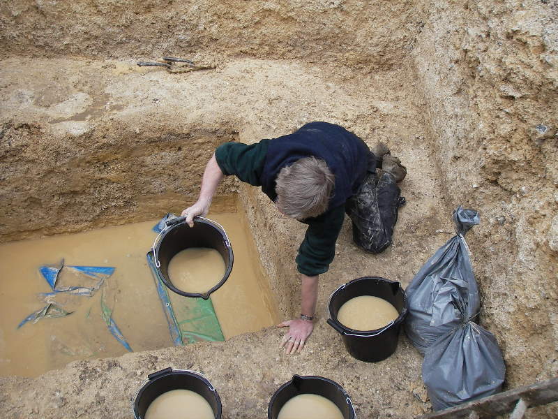
Rain in
the excavated pit.
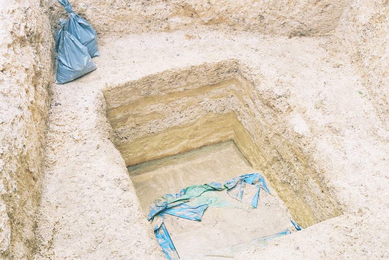
Cleaned
out.
I cannot adequately express the sheer
excitement of holding in your hand something that was made and has lain
there
where it was dropped 485,000 years ago. You hold it, look at it and
just know
you are the first person to touch this for half a million years. Then
even more
exciting in a small area four axe sharpening flakes, left where they
were
dropped when putting a new edge on an axe. You really had to be there.
Everyone
crowds round. Everyone wants the first look. Cameras appear. The bits
are
really tiny but they are so special. I can go on for hours about this
and
months later the moment is still vivid in your mind.
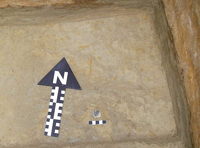
A
precious find emerges!
Never mind digging up a Roman Pot or a
medieval jug this stuff is 250 times older. I am sure you, when reading
this,
think I am a bit daft but let me tell you this is a real wow! moment or
should
I say a Wow! Wow! Wow! moment. Then its soil samples, photographing,
drawing
and recording, measuring everything in with the total station and
clearing up
and the start of the post excavation work.
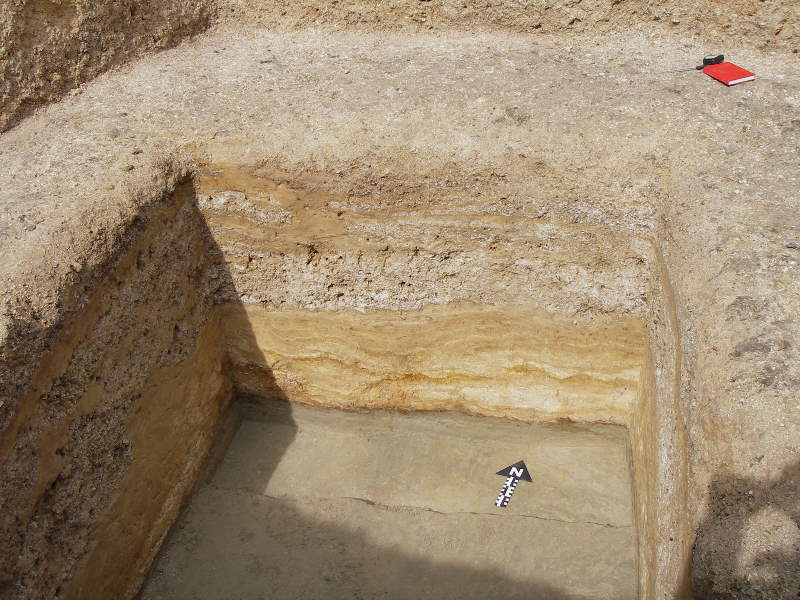
The find
in context.
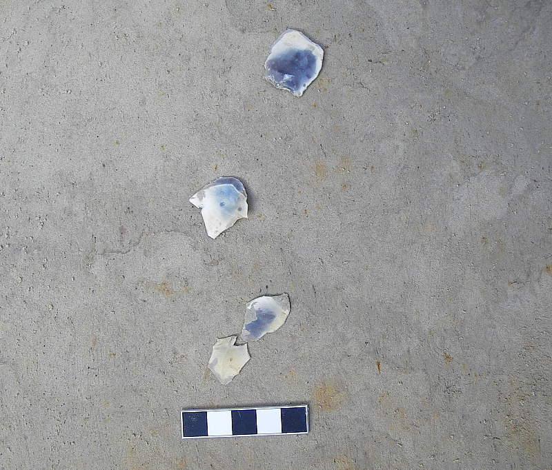
More finds!
The mechanical digger quickly fills in
all that work and we are back to the muddy path, the cars, the drive
home and a
very satisfying large scotch.
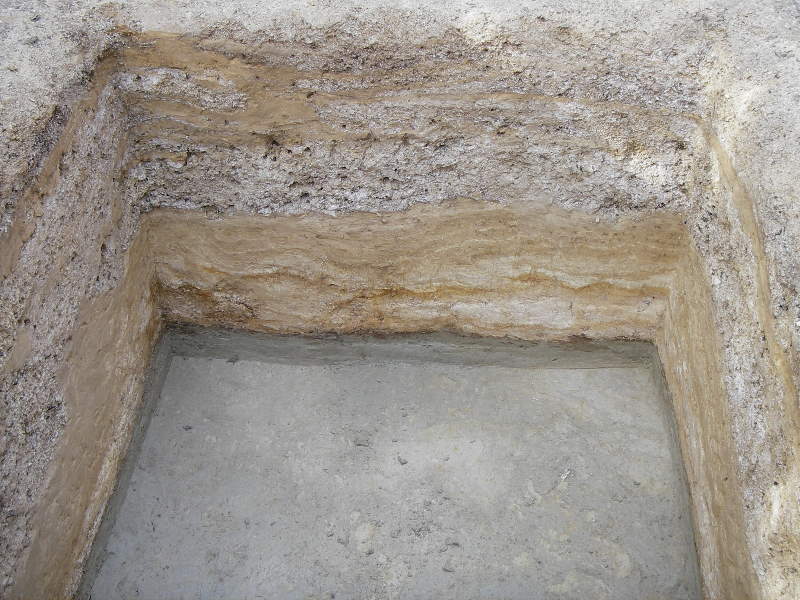
Pit at
dig's end.
I have no idea how many tons of material
has been removed and put back or how many hours of labour went into
that small
handful of flint but was it all worth it? For me an unequivocal yes and
would I
do it again, yes, because that’s archaeology.
So what do we know about this early
peoples and their environment. To answer that question we need to go
back to
Boxgrove.
100,000 years before the emergence of Neanderthal a
large brow hominid roamed this land. Descended from
Egaster, Heidelburgensis
with his basic flint tools was the master of all he surveyed. He
inhabited this
part of the world probably from the East across east Dogger Land that
would
later become Holland. The climate was easy and the land rich in
wildlife. Red
Deer were in profusion and so the living was good and it would be many
centuries before the onset of the Anglian Ice Age.
A small area in the South of England was
ideal for living as an embayment provided grass land sheltered from the
prevailing winds, salt marsh with a profusion of shell fish and a ready
supply
of flint outcropping from the chalk cliffs.
The main tool of the period was the hand
axe and over 300 were recovered from Boxgrove. These multi purpose
tools were
the Swiss
army
knife of its period and it is thought that they also may
have
had a social connotation as well as a hunter gatherer implement. Social
standing could have been signified by the perfect hand axe and sexual
display
was not ruled out. The living was a family gathering type grouping with
man,
women and child all belonging to a social network. The role of the
males would
have been very much the hunters but after the kill everyone would have
joined
in the preparation of the carcass and the amount of bone found with cut
marks
indicates a fairly sophisticated level of dismemberment with little
wastage.
The silt beds at Boxgrove were covered
with a fine deposit from slow flowing water so the preservation is
perfect in
every detail. Today things were still in the same position as they were
half a
million years ago when they were covered. A kill would have fed the
group for a
considerable period so there must have been time for teaching others
and being
with children that would have further added to the development and
survival of
the group.
There is not that much we can tell about
the day to day life of Heidelburgensis but it is just possible that a
crude shelter
was erected just next to where my garden shed
is today and was
the home
for about 20 people and I can just imagine dad and his two brothers
coming up
what would become my garden
path with a young deer and being greeted
with the
excitement of a good feast tonight.
We know really very little about Heidelburgensis
but if we were to meet him on the street today would he be out of
place. An
adult male was about six feet but much sturdier than today’s males. The
body
lacked prolific hair and the flat face and stereoscopic vision made him
very
much like us. The rib cage tapered towards the bottom of the abdomen
which indicated
that the gut brain ratio was in tune with modern man and this in turn
indicates
a full and nutritious diet. With his stone axe Heidelburgensis had
access to
parts of a kill that were the highest protein, bone marrow and the
brain. His
tools kit contained the right equipment to get into heavily boned areas
and
therefore it is not inconceivable that he was a scavenger of any kills
in the
landscape even after the larger carnivores of the period had finished
with
their carcasses. The legs of Heidelburgensis tapered inwards from the
pelvis
again indicating a totally upright stance and the shoulder joints had
full
mobility to perform many tasks including throwing, climbing and
carrying.
It can therefore be assumed that this
was like us in many ways and possibly washed, dressed and with a
haircut our
primitive man could walk down my street without turning too many heads.
This then was the forerunner of
Neanderthal and Homo Sapiens. Driven out of this part of the world by
the
encroaching ice as the world cooled. Millennia would pass before the
land would
warm up and recover its foliage and animals but as this came about a
“new”
intruder was on this land.
Chapter
3 Digging for Neanderthals
We now enter a long period where I must
speculate. These are the periods of Neanderthal.
I am surrounded by areas of Neanderthal
habitation the nearest being just along the coast to the West of me at
Barnham.
The south east corner of what will eventually become the England that I
would
recognise. This area is full of places where our enigmatic ancestor
lived and
died such as Swanscombe, Clacton, Lynford in Norfolk, Purfleet,
Thurrock and
Hoxne
Following the Boxgrove finds the Anglian
cold stage wiped out all life but following this the first signs of
Neanderthal
were around the Hoxnian interglacial at 400,000BP but were quickly lost
due to
the onset of the next ice age, in due time the Perfleet interglacial
dawned and
back came Neanderthal.
The millennia following showed the same
pattern over and over again until we come to 120,000BP and the
prolonged
Ipswician interglacial when we had one of the warmest periods of the
last half
million years. The trees, plants animals in profusion were here but no
sign of
early man. Why, when conditions were so conducive to habitation we had
a period
of non humans is unknown but it would not be until a short interstadial
in the
Devensian ice age do we find the local appearance of my early
neighbours. There
is some evidence that England may well have been an island in previous
periods
when sea levels rose following the ice melt but this is not conclusive
as it
may well have been possible for Neanderthals to cross the English
Channel as it
was then
What was my back garden like in these
periods of habitation when Neanderthal reigned supreme as top of the
predator
chain? Neanderthals had a large brain case, buried their dead and
produced a
very sophisticated tool kit so we can imagine that life was somewhat
structured. The development of thicker set bodies and the ability to
survive
in a colder climate would have greatly helped with the diverse extremes
of
climate.
Butchery marks on animal bones show a
developed system of co-operation as on the mainly grasslands a kill
would mean
fast dismemberment of the carcase before the smell of blood attracted
the large
scavengers and hunters that contested for game.
I like to think that the extended family
was much more of a well knit group than Heidelburgensis and in my minds
eye I
can see my back garden now in use as a hunting camp with all the family
active
in one way or another as dad and his brothers and perhaps an eldest son
bring
home the butchered remains of a deer or perhaps an even larger
quadruped.
We know from skeletal remains from
France and Germany that Neanderthal was an active hunter as injuries
and breakages
mended are commonplace so I like to think that exactly where I now grow
gooseberries the Neanderthal group collected for their meal before
sleep on a
balmy evening. I can just see them happy, well fed and relaxed
sharpening an
axe in preparation for tomorrows adventure
Each time there was a re-emergence of
Neanderthal the tool kit changed often for a more and more
sophisticated way of
manufacture. The final incursions between 60,000 and 40,000 during a
short
interstadial in the Devensian showed the development of the elongated
leaf
point and it is in this period that our next excavation took place.
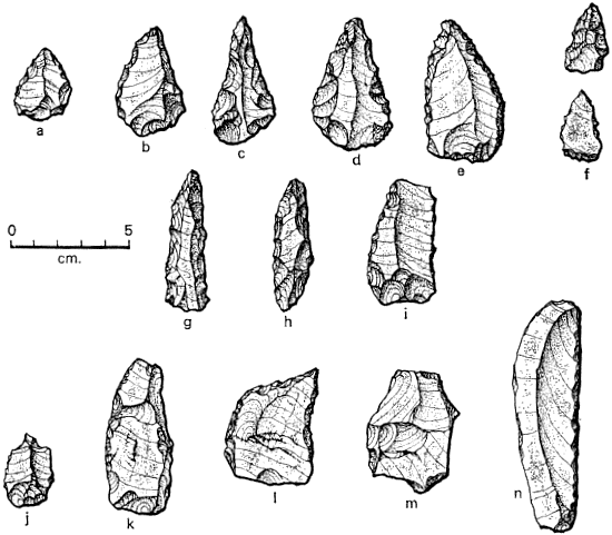
A
Neanderthal tool kit (
Photo: Dr
Ralph Solecki).
To understand the setting we have to
look at the scenery and structure of the South Downs the southern
residue of
the chalk and other cretaceous beds uplifted and then worn away and
stand on
the outcropping of the lower greensand overlooking the wealden clay 200
to 300
feet below us. If we look to the south there is an undulating terrain
of the
gault clay and upper greensand and about a mile away the rise of the
escarpment
of the chalk downs rising steeply another 300 to 400 feet. To the north
there
is a wide sway of grassland with sporadic trees and in the very far
distance
there is just visible the outline of the chalk escarpment of the north
downs.
This lower greensand gives up a
wonderful vantage point to see game crossing the plain and
would have made an ideal spot to become the
base for living and camping. Today the view from this position is still
stunning and allows you to see at least 40 miles on a clear day.
It all started with John Hartley of London
a consulting physician and fellow of the Linnean Society who, when
retired,
decided to build himself a house in Sussex. The year was 1900. Whether
it was
ostentation or just the need for grandeur the house was somewhat of a
monstrosity complete with fake crenulations and battlements. Named
“Beedings”
the house was soon referred to as Hartley castle by the local populace
as it
dominated the crest of the escarpment of the lower greensand.
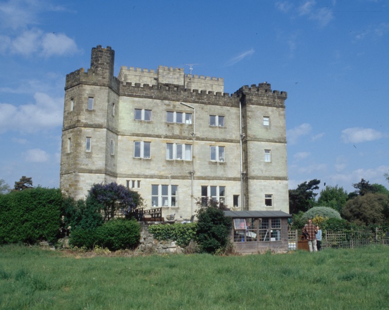
Beedings
"castle" (photo from Beedings
Project
website).
In laying out the foundations several
Roman finds were made including amphora, pottery and silver Roman
coins. The
digging soon revealed that there were a series of filled fissures on
the hill
crest and soon flint artefacts were being discovered. The first record
shows
“ten well worked flint flakes and two cores”. Building progressed and
Hartley
duly moved in and July 2010 his notes show trays of 2,300 fragments of
flints.
The finds were noted in 1911 to be of Palaeolithic origin but work done
by
Eliot Curwen, local archaeologist catalogued them as a Mesolithic
aboriginies
dagger factory and another member of the Curwen family Cecil went on
record
agreeing with this statement in 1954.
The sad history of the finds is that
they were donated in 1939 to the Museum of Archaeology in Lewes by
Harley’s
daughter and subsequently, as according to Curwen, they were of little
import
or value most of the collection was dumped down a well. The collection
now
consists of 199 pieces of flint and as there are 19 pairs of break
refits this
makes a total of 180 tools.
Starting with Jacobi in 1986 this
collection has now been re evaluated by several experts and pronounced
to be
Early Upper Palaeolithic and of Neanderthal manufacture. At this point
it is
permitted to give a small scream of frustration as the greater part of
one of
the world’s best Neanderthal assemblages was discarded through sheer
ignorance.
Following some geophysical work in the
field next to Beedings house, University College London wished to re
evaluate
the site and a team under the direction of Dr Matt Pope was set up to
excavate
a series of fissures or gulls, their correct title, in undisturbed land
20 feet
away from the house.
The digs that took place for two weeks
in the summers of 2007 and 2008 excavated seven trenches across the
gulls and
other features that showed up on the resistivity. The first task on any
site of
this nature is de turfing, a job not for the feint hearted as this is
thick
downland turf and then the careful troweling could be undertaken.
The gulls are cracks in the greensand
hilltop crest opening slowly as pressures on the Wealden clay below
increased.
In section each gull is a very deep v shape but at the surface anything
up to 4
metres wide. As these gulls formed they were continuously infilled with
silts
and clays and so resemble a knickerbocker glory with its tapering glass
and its
layers of goodies. Each section of layers in the gull represented an
older
period and therefore was really a time capsule waiting for us to dig to
the
correct layer. The top soil and just below contained a mixture of the
last
2,000 years with modern, medieval and Roman pottery as we descended.
The Neanderthal layer was approximately
one metre down in the centre of the gull but shallower nearer the
edges. There
is a natural movement of material the centre of the gull and this
causes
clastic dykes to form in the gull centre formed from larger pieces of
greensand
as they eroded into the gull. The lower greensand is rich in glauconite
that
oxidises and turns a very dark brown from the greenish yellow of the
undisturbed natural.
When excavated the clastic dyke looks
for all the world like a wall running down the centre of the trench and
we had
great fun allowing our site director the privilege of knocking it down
to allow
further excavations. At the time it was commented on that he had
demolished the
only Palaeolithic, Neanderthal, wall in existence but our Director is a
great
chap and took the kidding with great aplomb.
Every piece of flint on the site was
brought in and was either debitage or tools or broken tools. We have a
mixture
of piercers, scrapers, awls, burins and broken blades including one 5
faceted
tip about an inch and a half long. The importance of this discovery
made the
television six a’clock news and is downloadable from the web by
searching
“Beedings” or “lithics at UCL”.
All together a total of 164 finds were
recovered from site and the academic interest was great so we were
visited by
all the top people in Archaeology in the UK and it was a real pleasure
to rub
shoulders with and talk to the real professionals. [editor's note: visit the Beedings
website for more pictures and
information!]
So what did the site tell us about
Neanderthals? Their organisation ability for collective hunting and
planning
was apparent as was the selection of the site showing that hunting was
not just
a hit and miss affair. The finds show a level of technology that was
very
sophisticated compared with their forerunners and collectivisation
ensured a
safer and more stable structure to their society.
I am really pleased that my garden could
have been part of this era and that my bit of land nurtured and
assisted this most
important stage in evolution
Chapter
4 Round Houses
The Devensian ice age was particularly
severe in Northern Europe and the Americas and did not let up until
12,000 BP.
Then followed a brief episode of rapid cooling when it was believed
that the retreating
Laurensian ice sheet changed the course of the melt water flow out
through the
Great Lakes and the Hudson river. This is turn stopped the gulf stream
for a
few centuries so it was not until 11,000 to 10,000 BP that the climate
settled
down to allow Homo Sapien to return to my garden.
The topography at that time was very
different from today with Britain being a peninsular of Europe with no
North
Sea or English Channel. The great rivers of the Seine, the Rhine and
the Thames
all flowed westwards making a very wide barrier so the migration of
peoples was
not from France northwards into England as many texts would tell us but
through
Germany and Holland and then westwards into Southern England.
These new people of the Mesolithic were
still hunter gatherers and the terrain would have been mostly woodland.
Oak,
Elder and a variety of deciduous trees would have covered the landscape
but
here on the South Downs where the soil is shallow large stretches of
open
downland would have made this an idea habitat. Our ancestors would have
had to
compete with bear, wolf, wild pig and some fairly large quadrupeds to
carve
their existence out of this land.
This is the time of the microlith, tiny
detailed flint flakes that made compound tools. The proliferation of
tools was
immense over 120 tool types and a desire for the very best black flint.
The
numbers of people living in this area must have been quite considerable
and
with flint being so prolific the numbers of tools enormous. Every site
in
Sussex and Hampshire that I have been involved in has had prodigious
Mesolithic
blade finds and sporadic bits when walking the dog is common place.
From 6,000 to 8,000 BP the skills were
changing as the transition from hunter gatherer to farmer took place.
The
populous became far more static and the land clearances of trees
started to
make way for a new era that of the Neolithic.
New ideas of living meant new tools and
new usage of flint. Sickles adze, axes burins fabricators all changed
and if
possible even more tools, especially scrapers were used and discarded
into the
landscape to be found later on by me and others.
About 6,000 BC the melt waters of the
glacial stage raised sea levels to such a state that vast tracks of
Doggar land
became lakes and eventually were breached by the rising waters and
formed the
North Sea. This in turn made a massive surge of water down the great
river
channel and formed the English Channel cutting England from France.
During this whole time there was a
gradual change in the way we lived. The flint mines soon gave way to
henge’s, causeway
enclosures, long barrows and of course stone circles. Is there anyone
reading
this that has not heard of Stone Henge, seen the megaliths, wondered at
the
feat of human endeavour. Our landscape is full of hill forts, barrows
and
causeways many of them still very evident today. My garden is about a
mile and
a half from Cissbury one of the major hill forts on the South Downs
(try “Cissbury
Hill Fort” in your search engine or look in Google earth) so I can
totally
believe that this bit of land was hunted on and farmed during these few
millennia.
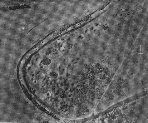
The South-West end of Cissbury Ring from the air (photo from Sussex
Archaeology website).
The Bronze age followed by the iron age
covered the 1,500 years BC and was a time of settlements and intensive
farming.
The hill tops were still in common use as defensive positions and at
Arundel
and Nore Hill 10 miles west of me there is an area of many square miles
that
was bounded by ditches and covered in lynchetts that gives a fair idea
of just
how many thousands lived in the local community.
Although I have no evidence I imagine my
garden was the site of a round house and banjo enclosure surrounded by
fields
of wheat and barley and a profusion of root and green vegetables. The
house was
24 feet diameter and thatched to keep out the rain and winter storms
and was a
home for mum, dad, children, relatives and in the winter the livestock.
Just up the road is a reconstruction at
Butser so I have a perfect idea of what it was like (click Butser
Iron Age Village to go to official website) the round house was the
centre of living for generations and
was usually surrounded by a bank and ditch with a narrow causeway
entrance thus
giving the name “banjo enclosure”. These enclosures often contained
three or
four round houses and showed that the community was larger than the
extended
family and was possibly the first concepts of village settlement.
Roundhouses at Butser Farm (photo by Bob Wishoff)
One June morning several years ago the
phone rang as I was just sitting down to breakfast. The BBC were
calling to say
that there was to be a television programme in the “Time Team Series”
in the
following month digging on the South Downs about a mile from where I
live and
would I like to assist in the programme. These calls do not happen that
often
when you get on national TV so I graciously condescended to accept (I
am
allowed a few bits of artistic licence in this text). So I was about to
become
a TV personality and with a very quiet Yippeee I casually spread the
news to
everyone I knew.
The programme was to re-investigate a
dig carried out by a local archaeologist by the name of John Pull back
in the early
part of the last century. On the South Downs just north of where I live
is
Harrow Hill, Cissbury Hill and Blackpatch an area covered with
Mesolithic flint
mines. John Pull had excavated several of these flint mines and had
also found
a large circular ditch that apparently had no entrance (try Blackpatch,
Cissbury, John Pull in your search engine)
The programme for Time Team was to
investigate what remained of these earthworks and mines as the area had
been
extensively ploughed in the 1950’s Broadcast in March 2006 (series 13
programme
151) the three days of excavation shown on the television had been
recorded in
the summer of 2005 and in reality took longer than three days.
The area of downland turf had been cut
before our arrival at 8-30 on the Friday morning and we assembled in
the farm
barn for a health and safety talk and a note that there could be
unexploded
munitions in the area as the hill was used during WW2 for the training
of
troops. We were then all issued with a wrist band to denote who was
officially
on site as workers and required feeding. Coffee and hot bacon
sandwiches were
the order of the day and I was feeling that I really could get used to
this
kind of Archaeology.
The walk up to the site was about a
quarter of a mile and we all stood around while the geophysical
research
started several days before was completed. We all watched as the
opening shots for
the TV programme were recorded and panoramic views of the site were
filmed and
the plans of John Pull’s recording were mulled over. By 11-00 we were
all a bit
fed up standing around when it was discovered that the interpretation
of the
original records was wrong and we were several hundred yards too far
south.
This meant getting the farmer and his
grass cutter out again and a further swathe of meadow cut. By this time
it was
lunch and we all trooped back to the yard for a really good BBC meal
cooked in
their massive on site trailer. I must say the food was excellent as I
had now
had two meals and not yet done anything.
By the use of a magnetometer several
sites had been identified and the round ditch, 30 metres diameter
discovered
and we arrived back on site to see a big yellow JCB starting to remove
the
turf. None of this de-turfing by hand on the TV programme, that is
apart from
the little bit done while the cameras were rolling.
The grass was thick downland turf and
below this about 10 to 20 cms of top soil and then a thin layer of sub
soil and
we were on the chalk. It is recorded that a considerable portion of
this part
of the downs was ploughed and bulldozed in the early 50’s to bring more
land
into agricultural use so you can imagine the relief when a part of a
great
circular ditch appeared as a brown stained gully under the blade of the
JCB.
The JCB was digging a blade width trench
across the anomaly so about a metre and
a half was exposed. It was then down to hand trowling to clean the
section and
my job to record the trench thus far. Then the ditch was dug and proved
to be
about 2 metres wide and a metre deep and V shaped. We know that the
John Pull
excavation had revealed the ditch several decades before
but it was soon discovered that the ditch was
not fully revealed, just the infill that left a layer about 10 cms
thick to the
original wall of the ditch so we had a sample for dating.
So ended my first day with a recording
of the section of the ditch exposed. As I was completing the drawing
the JCB
was behind me waiting to get into the trench to expose more of the ring
ready
for diggers the following morning.
Day 2 started bright and early and we
arrived on site to see that over half of the ring ditch had been
exposed so an
army of diggers set to work to expose
the ditch in 2 metre sections with 2 metres between each worked
section. And so
we each had our own small bit to excavate. Before mine was complete I
was
called away by the site Director to record other trenches that a second
JCB had
uncovered looking for small circular features that had been recorded by
the
John Pull dig. It was thought that these were possible round houses or
smaller
circular enclosures but no evidence was found as the land had been
ploughed
away.
What we did find in profusion was tree
throws as this was the time of the land clearances and trees
were
ripped
over
rather
than
being
felled. A tree throw is very distinctive and leaves an imprint of a
crescent
shape almost exactly the shape of a turf edging spade.
On the far side of the slope there had
also been clearances of an area of flint mines and round houses that
had shown
up on the magnetometer survey and two of these had been cleared of turf
showing
the circular row of post holes and the shallow drip ditch. The houses
were cut
into a slight slope so were deeper into the hill side at the back. The
ditches
had to be excavated with care as often there are prenatal burials in
them. On
another site we had found two burials in the same round house and it is
not
known if the children were still born or died at child birth. The one
thing we
were sure was that this was not a sacrificial offering although we have
found
headless chickens buried in foundation before that were sacrificial
offerings.
The flint mine was as we thought just an
in-filled pit so no further work was done as we could have gone down 10
or 12
metres and time did not permit.
By day three the whole site had been
cleared and a large tree throw appeared in the centre of the ring
surrounded by
small pits capped with a flint nodule. In each of the pits was a small
object,
a piece of pottery, a flint tool, and some were stained so obviously
something
biodegradable had been put there. Lots of filming went on and it was
also the
open to the public day so lots of parties turned up to look and comment.
A large pit was discovered next to the
tree throw and this was filled with large flint nodules that had been
mined
from the other side of the hill. So what was this place? Unfortunately
we do
not know but resorted to good old standby of “religious significance”
“ritual activity”
Whatever was happening here no one was
living in this part of the Downs. The pits were obvious token burials
and the
main pit was flint taken from the mines and put back into the ground.
Your
guess is as good as mine.
Although Time Team is supposed to go for
three days on the fourth day I was back helping to record the full
site. Then
the back fill and clearing up just shows you how misleading a TV
programme can
be. This then was the Mesolithic and I can believe that these people
travelled
down the hill a bit and camped and lived in my plot of land. So my
front garden
could have been a ritual site as well so I can add another chapter as
to who
owned this land.
Chapter
5 Here come the Romans
The Month was September the year 55 BC.
Ships seen off the coast at Dover marked the massive change that was
starting
in my garden. Julius Caesar was trying to gain power by extending the
Roman
Empire. The landing at Deal was less than spectacular as he lad been
separated
from all his cavalry but none the less he fought his way off the
beaches and
Britain had been invaded. Over the next two months the Roman invaders
marched
on to the Thames at London had a few battles and then before winter set
in
returned to Gaul. The conquering of Britain was mainly political to get
“Britanicus” as an added name and the setting of taxes as tribute was
instantly
forgotten but the first signs of a new world order were there.
It would take another 98 years before
Claudius brought back the Roman army in 43 AD and by then Britain was a
trading
outpost of Roman Europe and so quite a few tribes, especially along the
south
coast, welcomed the Romans as friends especially the Atrebates, later
to be
called the Regni and their king
Togodumnus. The South coast became immediately a client kingdom and a
magnificent palace was built to show his Roman status (put Fishbourne
Roman
Palace in your search engine). The Roman landings were all along the
South
Coast and as I have a good landing beach in my town of Worthing I can
just see
the Roman infantry being welcomed by the locals and building a marching
camp on
my front lawn.
Part of the geology of Sussex is that
there is a strip of highly fertile soil called brick earth that is
about half a
mile wide that runs parallel to the downs and the sea (referred to in
our
Heidelburgensis dig). This strip was exploited by the Romans and was
settled
with farms along its whole length from Portsmouth to Brighton. Many of
the
farms were tenanted or owned by the local populace and were very
quickly
Romanised. The round house and the enclosure soon gave way to the villa
and
ditches and the Iron Age way of life was no more.
From London northwards the Romans faced
fierce opposition epitomised by Queen Bodicea (pronounced boo-dik-a)
and
several years and several emperors were to come and go until in
Hadrian’s time
England and parts of Scotland and Wales were tamed and under Roman law.
North
of Hadrian’s wall and the Antonine wall there were the barbarians of
Scotland
who were never conquered.

Queen
Bodicea.
So my garden was farmed and settled
until 410 AD by either Romans or Romanised Britain’s and for those four
centuries this was a stable landscape with farms, herds of domesticated
animals
and markets and trading centres. As my garden has very good and fertile
soil I
am sure I was part of an estate in these years and this creates further
images
of who was here and how they lived.
A few miles to the west is a series of
farms in and around the Town of Arundel and its river the Arun. One of
the
farmers, Luke Wishart, a friend of mine, said one day would you like to
look at
my Roman site? And proceeded to tell me that pottery had turned up in
his field
and on a very dry year strange parallel markings had shown up in his
crop. We
walked over to the field that is a sizeable piece of land of 10 or 12
hectares
and waving his hand in a general direction Luke said “in that sort of
area” “It
was a few years ago so I do not remember exactly where”.
The following weekend several of us,
with the land owners permission, had a general wander over the field
and in the
space of 30 minutes had bags of brick and tile, worked flint, CBM
(ceramic
building material) and about 15 pieces of fineware pottery including
three bits
of Samian pot. Samian for the uninitiated is the Gallo Belgic and Gaul
manufactured high status Roman pottery. If you find Samian it means
very rich
living as only the top rank of the times could have afforded such
luxuries. And
after a few minutes we had three pieces. This was another of those
“wow”
moments.
We all looked at each other but no one
wanted to say much as three bits of pot does not make a villa but the
excitement was there. So these few moments was the start of quite a lot
of
digging as we did not know it then but we had found the missing Roman
Villa.
